


Outside Virgin Town #VI89.2 Voting District, Washington County, Utah
About
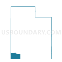
Outline

Summary
| Unique Area Identifier | 680452 |
| Name | Outside Virgin Town #VI89.2 Voting District |
| County | Washington County |
| State | Utah |
| Area (square miles) | 278.24 |
| Land Area (square miles) | 278.17 |
| Water Area (square miles) | 0.07 |
| % of Land Area | 99.98 |
| % of Water Area | 0.02 |
| Latitude of the Internal Point | 37.27218890 |
| Longtitude of the Internal Point | -113.04076660 |
Maps


Graphs
Select a template below for downloading or customizing gragh for Outside Virgin Town #VI89.2 Voting District, Washington County, Utah


Neighbors
Neighoring Voting District (by Name) Neighboring Voting District on the Map
- Cedar Mountain Voting District, Kane County, UT
- Hurricane #HU52 Voting District, Washington County, UT
- La Verkin #LA85 Voting District, Washington County, UT
- Mount Carmel 10 Voting District, Kane County, UT
- Outside Apple Valley #AV51.2 Voting District, Washington County, UT
- Outside Apple Valley #AV51.3 Voting District, Washington County, UT
- Outside Apple Valley #AV51.4 Voting District, Washington County, UT
- Outside Cities and Towns #OUT5 Voting District, Washington County, UT
- Rockville #SP95.2 Voting District, Washington County, UT
- Springdale #SP95.1 Voting District, Washington County, UT
- Virgin #VI89.1 Voting District, Washington County, UT
- Zion National Park #SP95.3 Voting District, Washington County, UT
Top 10 Neighboring County Subdivision (by Population) Neighboring County Subdivision on the Map
Top 10 Neighboring Place (by Population) Neighboring Place on the Map
- Hurricane city, UT (13,748)
- La Verkin city, UT (4,060)
- Virgin town, UT (596)
- Springdale town, UT (529)
- Rockville town, UT (245)
Top 10 Neighboring Unified School District (by Population) Neighboring Unified School District on the Map
Top 10 Neighboring State Legislative District Lower Chamber (by Population) Neighboring State Legislative District Lower Chamber on the Map
Top 10 Neighboring State Legislative District Upper Chamber (by Population) Neighboring State Legislative District Upper Chamber on the Map
Top 10 Neighboring 111th Congressional District (by Population) Neighboring 111th Congressional District on the Map
Top 10 Neighboring Census Tract (by Population) Neighboring Census Tract on the Map
- Census Tract 2701, Washington County, UT (8,839)
- Census Tract 2710, Washington County, UT (4,113)
- Census Tract 2709.01, Washington County, UT (3,796)
- Census Tract 1301, Kane County, UT (2,297)
Top 10 Neighboring 5-Digit ZIP Code Tabulation Area (by Population) Neighboring 5-Digit ZIP Code Tabulation Area on the Map
- 84737, UT (14,838)
- 84745, UT (4,066)
- 84774, UT (1,399)
- 84757, UT (1,167)
- 84767, UT (679)
- 84779, UT (641)
- 84758, UT (533)
- 84762, UT (248)
- 84763, UT (245)
- 84755, UT (112)